Highest Peaks in Texas


Given the vast size of the Lone Star State, it’s no surprise that you’ll find Mother Nature’s work in all its glory there. Its rich tapestry of scenery includes dusty, expansive deserts, lush forests, jaw-dropping canyons, and of course, many towering mountains.
All of Texas’s highest mountains are found in west Texas, in a mountainous region known as Trans-Pecos, which rises out of the Chihuahuan Desert. Several mountains here rise over 8,000 feet and the vast majority of them are in the Guadalupe Mountains National Park.
One of two National Parks in Texas (along with Big Bend National Park), it’s about 100 miles east of El Paso, and adjoining the border with New Mexico to the north.
Let’s take a look at the 13 highest mountain peaks in Texas.
1. Guadalupe Peak
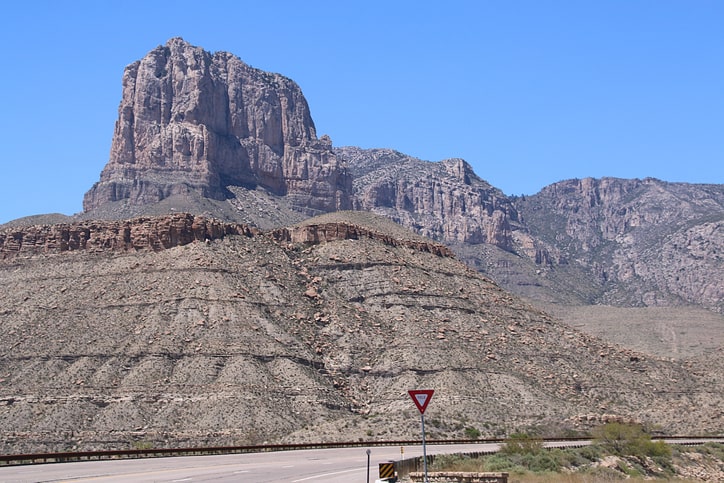
Location: Guadalupe Mountains National Park, Culberson County Elevation: 8751ft (2667m)
The highest point in the state of Texas is Guadalupe Peak. Perhaps unsurprisingly, it’s also the Park’s most popular mountain for hikers.
Perhaps the reason for this is that it is one of the closest peaks to Pine Springs, the Park’s hub which serves as a visitor center, campground and trailhead.
Climbers can follow the well-established Guadalupe Peak Trail from here to the ‘top of Texas’. The 8.5-mile round trip has an elevation gain of 3000 feet and can be completed in 6-8 hours by an average hiker.
The Guadalupe Mountains form one of the world’s largest fossilized marine reefs. They are formed from limestone and are around 265 million years old. Around 20-30 million years ago, tectonic activity forced the rock upwards to create many of the impressive outcrops that can be seen around the mountains.
2. Bush Mountain
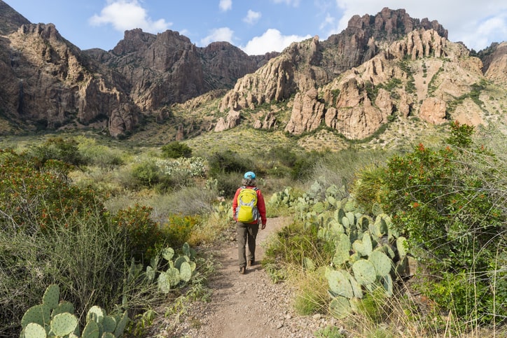
Location: Guadalupe Mountains National Park, Culberson County Elevation: 8361ft (2361m)
The second-highest peak in Texas lies 3 miles northeast of Guadalupe Peak. It’s somewhat more remote, being over 6 miles from Pine Springs. You can also hike from Dog Canyon Campground, but either way, hiking here is likely to take over a day and therefore involve a night of camping out in the wilderness.
The Bush Mountain Campground lies very close to the summit and offers stunning views of the sunset. The ponderosa pine trees that cover huge swathes of the mountain slopes offer some protection from the frequent high winds.
The diverse landscape around Bush Mountain (and indeed all of Guadalupe Mountains National Park) supports an amazing array of wildlife. A huge variety of plants and trees can be found both on the mountain slopes and on the floors of the canyons.
Many of America’s iconic animals can be found in the Park, with the woodlands home to elk, black bears, mountain lions, and deer. The desert floor comes alive at night, when coyotes, kit foxes, and many species of reptiles including rattlesnakes and geckos, take advantage of the cooler temperatures.
3. Shumard Peak
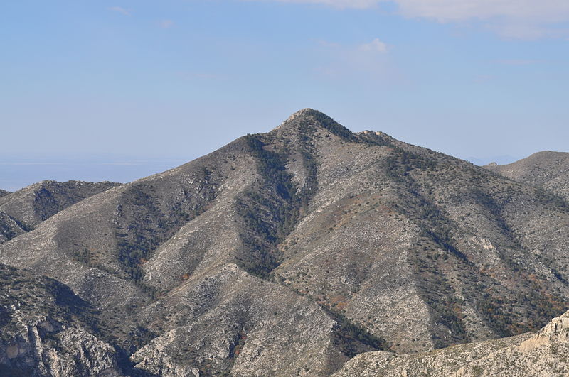
Location: Guadalupe Mountains National Park, Culberson County Elevation: 8615ft (2626m)
Though it’s only a mile northwest of Guadalupe Peak, number three on the list is considered by some to be the most challenging peak to reach. No trails lead to the peak, and reaching it usually involves a challenging trek over several switchbacks. The west-facing side of the peak is a dramatic sheer wall that juts up from the side of the mountain range.
It’s named after George Getz Shumard, a geologist who made several important discoveries in Texas in the 1850s, including the presence of fossils in the Guadalupe Mountains.
4. Bartlett Peak
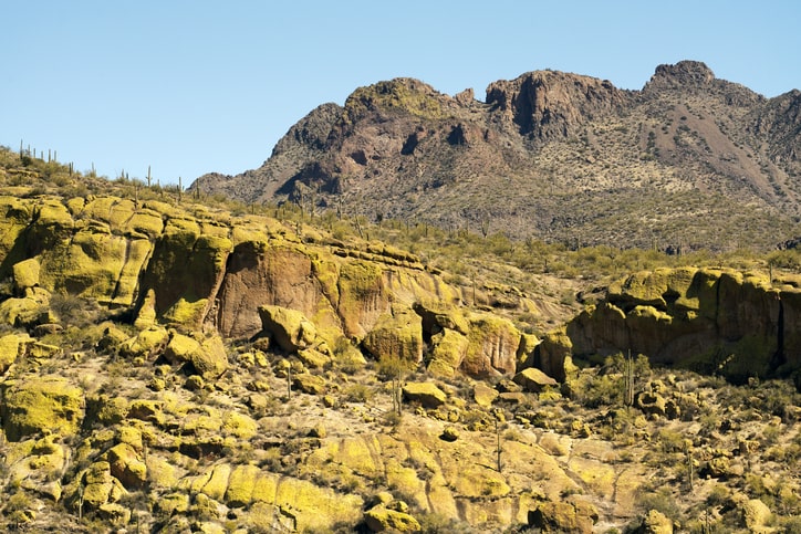
Location: Guadalupe Mountains National Park, Culberson County Elevation: 8508ft (2593m)
Though it sits only a short distance from Shumard Peak, this is another one that is very difficult to access due to the absence of any trails and the presence of a sheer wall to the west. However, if you can manage to hack your way through the dense brush that covers much of the mountain’s slopes, the views are spectacular.
It’s named after John Russell Bartlett, a US Boundary Commissioner responsible for surveying the boundary between Mexico and the USA in the 1850s.
5. Baldy Peak (Mount Livermore)
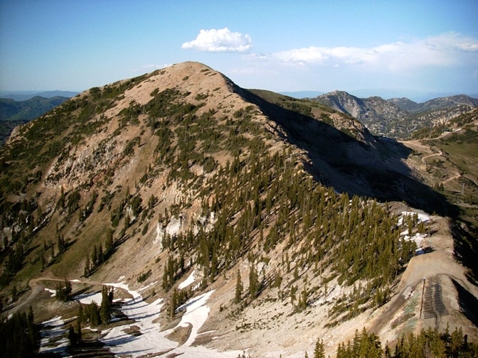
Location: Davis Mountains, Jeff Davis County Elevation: 8378ft (2554m)
The tallest mountain in Texas that isn’t in the Guadalupes, Mount Livermore is found just over 100 miles to the southeast in the Davis Mountains.
This smaller but perhaps more rugged mountain range is considered a ‘sky island’ as it rises sharply out of the surrounding lowland desert. This gives it a cooler, wetter climate, therefore the range is able to support a more diverse array of wildlife than the surrounding area. This makes it an important conservation area.
Baldy Peak refers to a protrusion of rock, shaped like a fin, which adds around 300 feet to the height of the mountain. Some confusion occurs when referring to the mountain. Some use Mount Livermore and Baldy Peak interchangeably to refer to the whole mountain, while others consider them to be separate peaks.
The area is owned by the Texas Nature Conservancy and visitors must obtain permission to access the mountains.
6. Hunter Peak
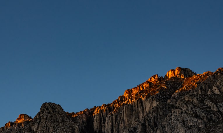
Location: Guadalupe Mountains National Park, Culberson County Elevation: 8368ft (2551m)
Heading back to the Guadalupe Mountains again, this peak lies just to the north of Pine Springs Visitor Center. Well-established trails begin from here, either to the east or west of the mountain and round to the gentler slopes of the northern side. The south side is adorned with dramatic cliffs that tower above Pine Springs, making access impossible for most.
It’s considered by some to have the best views of any peak in the Guadalupe Mountains. Southwards offers spectacular vistas of the desert, while to the north you can peer into the heart of the mountain range, with the nearby Guadalupe peak looming to the west. Despite this, it’s not a particularly popular peak, with many visitors opting for Guadalupe Peak.
7. Mount Pratt
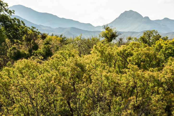
Location: Guadalupe Mountains National Park, Culberson County Elevation: 8342ft (2543m)
North of Hunter Peak and a long way from any of the Park’s trails, this lonely peak doesn’t get many visitors.
It’s possibly named after Wallace Pratt, the geologist who built Pratt Cabin as a vacation home in the 1930s. The cabin provides a rest spot and picnic area for hikers on their way to the popular McKittrick Canyon.
8. El Capitan
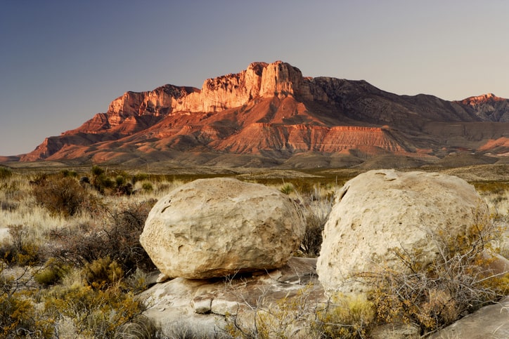
Location: Guadalupe Mountains National Park, Culberson County Elevation: 8085ft (2464m)
It may be the eighth-highest peak in Texas but it may be the most iconic. Forming the southern tip of the Guadalupe Mountains Range, it bursts impressively out of the desert floor. The 62/180 Highway swings within a mile or so of the peak, so the image of El Capitan looming over the road leaves a lasting impression on many who drive by.
While the rutted sheer walls of El Capitan's southern face may seem like a climber’s paradise, it’s rarely scaled due to the unstable nature of the limestone rock. While no trail leads to the top, it can be accessed by summiting Guadalupe Peak and then scrambling down its southern slope to El Capitan.
The Guadalupe Mountains Violet is an extremely rare flower that only grows high on the vertical limestone faces of the Park’s limestone cliffs.
9. Lost Peak
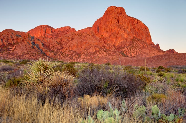
Location: Guadalupe Mountains National Park, Culberson County Elevation: 7839ft (2387m)
Found among the gentler slopes in the north of Guadalupe Mountains National Park, Lost Peak is one of the most accessible peaks on the list.
The Tejas Trail, one of the Park’s most popular and well-established trails, leads almost directly to the peak. Expansive views across the rolling hills and sweeping desert await those who make the trip to the summit.
10. Emory Peak
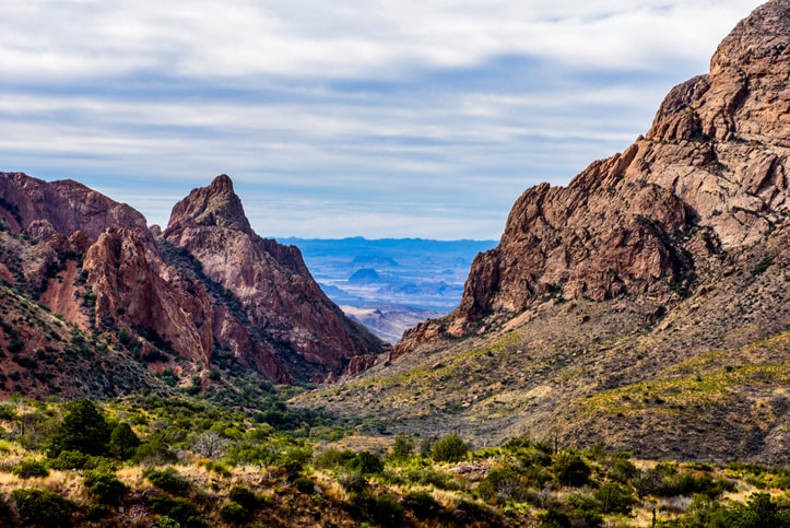
Location: Big Bend National Park, Brewster County Elevation: 7824ft (2385m)
Emory Peak is the tallest peak in the Chisos Mountains, a 40-square-mile bowl-shaped range in Big Bend National Park.
The most popular way to reach the trail is to start from the Chisos Mountains Visitor Center and take the Pinnacles Trail through the forest. Then join the Emory Peak Trail at the junction.
The final section of the trail involves some scrambling to reach the summit, but the rewards are spectacular 360-degree views across the mountains and desert below. It’s about a 10.5-mile round trip.
11. Brooks Mountain
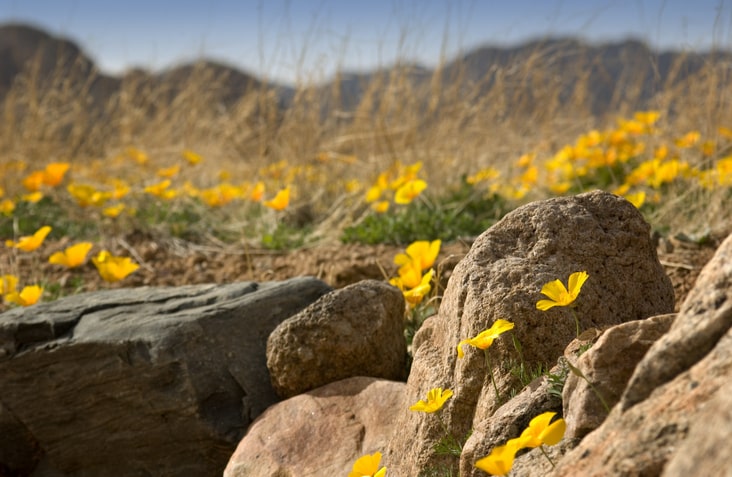
Location: Davis Mountains, Jeff Davis County Elevation: 7779ft (2371m)
The second-highest peak in the Davis Mountains is not particularly well-known and is rarely scaled. It sits about 3 miles to the west of Baldy Peak.
The Davis Mountains were formed by volcanic activity around 35 million years ago. The javelina, or collared peccary, is one of the most common animals to be found here.
These mammals resemble small pigs, though they are not closely related to them. They are widespread in many of the mountainous, semi-arid regions in west Texas.
12. Chinati Peak
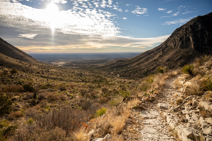
Location: Chinati Mountains, Presidio County Elevation: 7728ft (2355m)
The Chinati Mountains are a small range in the far west of Texas, close to the border with Mexico. The highest point is Chinati Peak, which sits near the center of the mountains surrounded by canyons and smaller peaks.
The Chinati Mountains are on privately owned land and are inaccessible to the public. However, roads that pass by the range offer amazing views of the dome-shaped peak as it rises above the desert.
Unlike some other mountains in Texas, the slopes are not forested. Instead, they are covered with the grasses, cacti, and scrub that are found throughout the Chihuahuan Desert.
13. Paradise Mountain
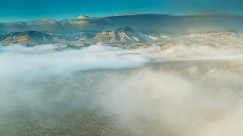
Location: Davis Mountains, Jeff Davis County Elevation: 7720ft (2353m)
Located near the southern end of the Davis Mountains, Paradise Mountain is another little-known mountain. The absence of any nearby trails and the presences of taller peaks in the area mean it’s not popular with hikers.
It does however have a villa that offers holidaymakers seclusion, stunning views and a touch of luxury at an elevation of 600 feet.
Exploring Higher and Higher
Texas is littered with dozens more mountains that spring up from the desert floor, with over 40 peaks above 7000 feet.
While The Lone Star State may not be famous for its mountain, the peaks of Texas can certainly provide some unforgettable experiences.
Their rich and varied geology and diverse ecology also offer plenty to excite scientists and natural historians. Texas also has lots more to offer, with its National Parks and many more areas managed by the National Park Service.
About the author


